

Texas State Executive City and County Executive Laminated Wall Map Poster
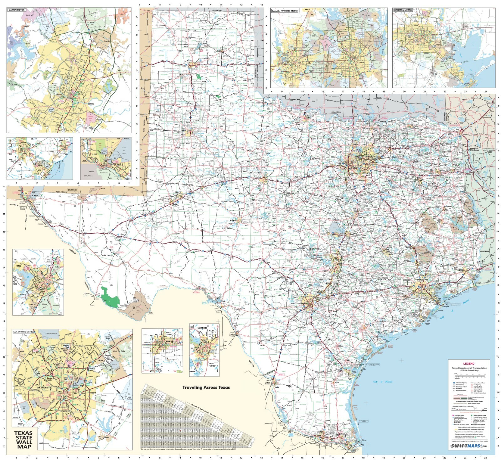
The Swiftmaps.com State Executive City-County Wall Map series are available for all 50 states. State wall maps include all state/federal highways, major waterways, towns, military installations, major airports, state universities, points of interest, cities, state parks and wildlife areas. Major cities will be inset in greater detail and a city index is included on the face of the map. Mapping data is provided by state departments of transportation (DOT) to make our wall maps the best possible reference tool for businesses, decoration or educational purposes. All Swiftmaps.com state wall map are printed in full color and laminated with a durable 3mil lamination for protection and dry-erase use.Map sizes available are approximately 36x48 or 48x70. Choose your size in the drop-down menu above. Note that dimensions can very a little from the standardized sizings above based on the actual configuration of state map boundaries and insets that are included to make the map more detailed and useful. Please inquire if you have additional questions.
Specifications
| Return Shipping Will Be Paid By | Seller |
| All Returns Accepted | Returns Accepted |
| Item Must Be Returned Within | 30 Days |
| Date Of Creation | Current |
| Country/Region Of Manufacture | United States |
| Original/Reproduction | Original |
| Type | Wall Map |
| Subject | Travel & Transportation |
| Brand | Swiftmaps.com |
The Swiftmaps.com State Executive City-County Wall Map series are available for all 50 states. State wall maps include all state/federal highways, major waterways, towns, military installations, major airports, state universities, points of interest, cities, state parks and wildlife areas. Major cities will be inset in greater detail and a city index is included on the face of the map. Mapping data is provided by state departments of transportation (DOT) to make our wall maps the best possible reference tool for businesses, decoration or educational purposes. All Swiftmaps.com state wall map are printed in full color and laminated with a durable 3mil lamination for protection and dry-erase use.Map sizes available are approximately 36x48 or 48x70. Choose your size in the drop-down menu above. Note that dimensions can very a little from the standardized sizings above based on the actual configuration of state map boundaries and insets that are included to make the map more detailed and useful. Please inquire if you have additional questions.
Related Items