


Antique World Wall Map Poster Old World Style Modern Info 36"x24" Laminated
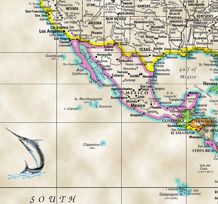
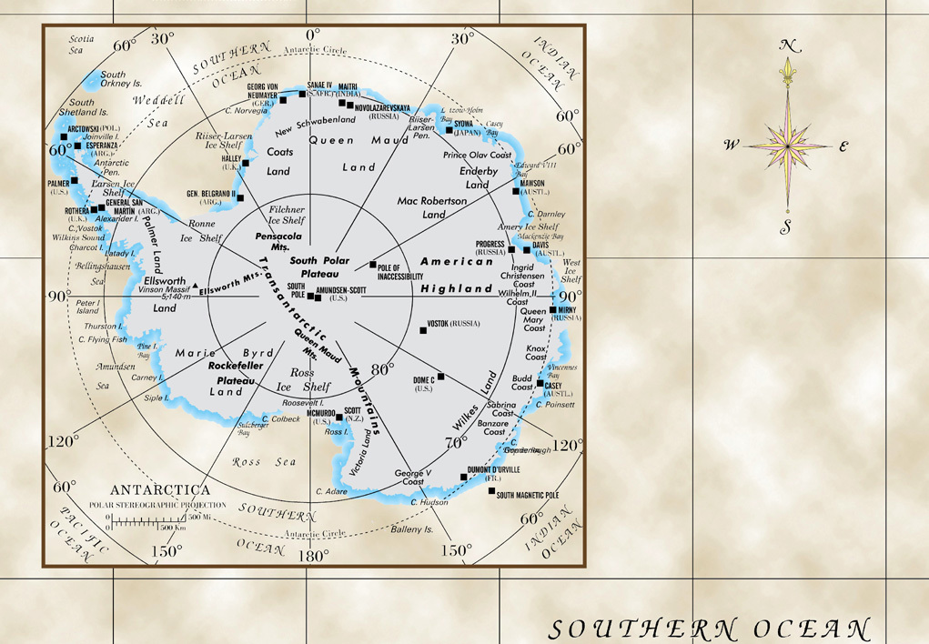
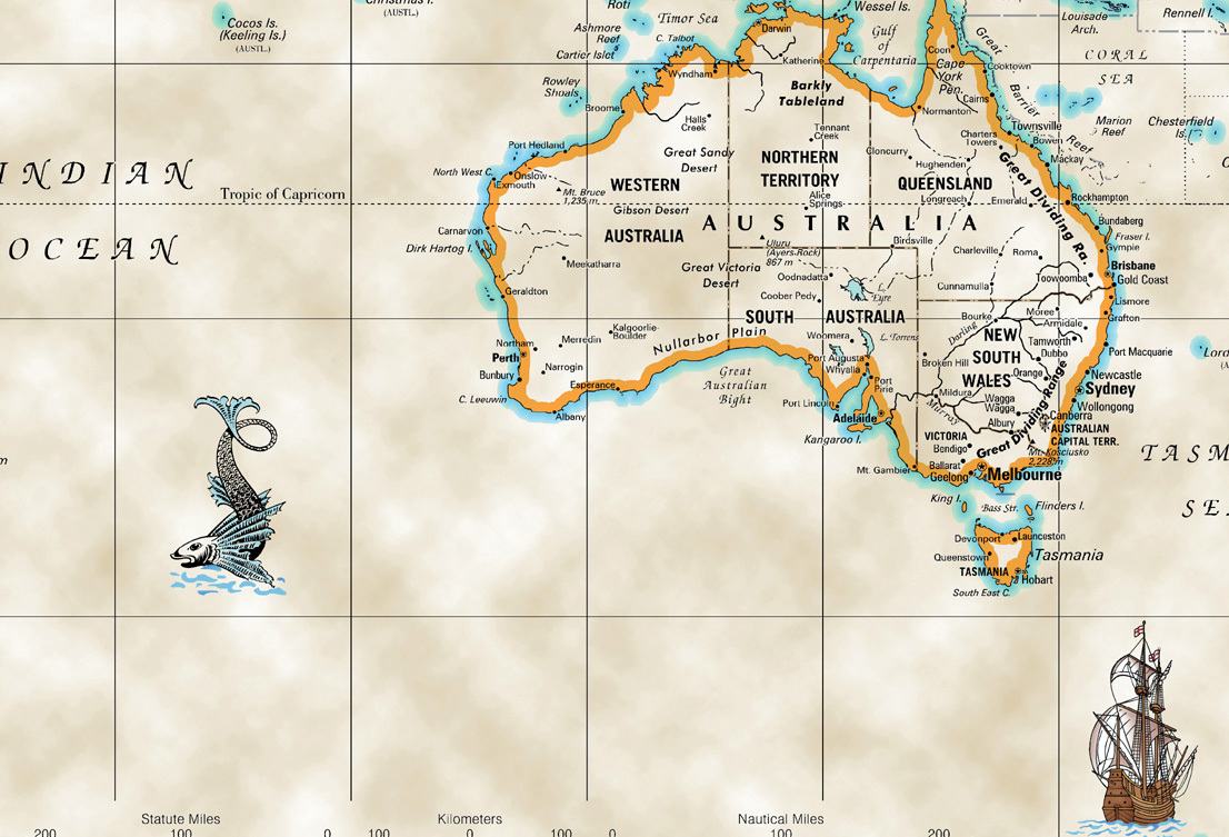
ANTIQUE WORLD WALL MAP Old World style - Laminated Poster by Cool Owl Maps This Old World Style modern WORLD wall map - Rolled Paper 36"x24" inches, features a wealth of information including current (2016) country boundaries as well as capitals, major cities, and geographical features. Also, includes an inset of Antarctica. Maps are placed on a "parchment" like background along with a selection of illustrations to give it the old world vintage look. Made to fit stock print size frames. World show U.S. states, Canadian providence, UK country states, and Australian state/territories. Appropriate for Home and Office decor. PRODUCT FEATURES: WORLD Old World StyleFits stock frames (36"x24" inches)Laminated Color banded countries Unique antique looking background Made and Printed in USA 2019 Important information FORMAT: Laminated WIDTH 36" x HEIGHT 24" SHIPPING: *Allow 1-4 Business days for USA; 10-14 for International; SHIPS FROM: NJ AVAILABILITY: In Stock *Please remember that the we have no control over the Post Office delivery time. FOR OTHER MAP PRODUCTS MAPS, REFERENCE ATLASES, TRAVEL MAPS & ATLASES BUY IT AT OUR EBAY STORE (click here) HAMMOND - USA Political style folded map 50"x38" $7.99 The HAMMOND USA Political style folded wall Map (W50" x H38") displays a Lambert projection with color banded state coverage, including state capital, major cities and highways. Also, it has various city insets along the bottom. Relief mountain shading for a 3-D effect. BUY IT AT OUR EBAY STORE SORRY NOT AVAILABLE Customer Service Policy: Cool Owl Sales is committed to customer service. All of our products are brand new. If you receive a wrong or damaged product, we will gladly re-ship you a replacement right away. Return Policy: We offer a 30-day Standard Return Policy on our eBay orders. Returned products must be in their original package and must be brand new unused. Buyer pays return shipping. Shipping Options: USA USPS Media Mail (2-9 business days): N/A USPS Priority (1-4 business days): UPS Ground (1-6 business days): N/A WORLDWIDE USPS (varies): We will ship to: USA and Worldwide Most of our products are offered with free shipping, meaning shipping might have been included in the price to provide you with the total cost of the order. Delivery times are estimates. We have no control over delivery services time. Thank you for shopping Cool Owl Sales! Your online one-stop for all your mapping needs! We are map experts with over 30 years of experience. We offer many top of the line products. If you have any questions, just send us an email, and we will be glad to help you out! Buy from us with confidence!!!
Specifications
| Return Shipping Will Be Paid By | Seller |
| All Returns Accepted | Returns Accepted |
| Item Must Be Returned Within | 30 Days |
| Refund Will Be Given As | Money Back |
| Features | Laminated |
| Subject | World |
| Date Of Creation | 2019 |
| Brand | Cool Owl Maps |
| Style | Antique |
| Color | Antique - Toned |
| Theme | Art |
| Type | Poster |
| Original/Reproduction | Original |
ANTIQUE WORLD WALL MAP Old World style - Laminated Poster by Cool Owl Maps This Old World Style modern WORLD wall map - Rolled Paper 36"x24" inches, features a wealth of information including current (2016) country boundaries as well as capitals, major cities, and geographical features. Also, includes an inset of Antarctica. Maps are placed on a "parchment" like background along with a selection of illustrations to give it the old world vintage look. Made to fit stock print size frames. World show U.S. states, Canadian providence, UK country states, and Australian state/territories. Appropriate for Home and Office decor. PRODUCT FEATURES: WORLD Old World StyleFits stock frames (36"x24" inches)Laminated Color banded countries Unique antique looking background Made and Printed in USA 2019 Important information FORMAT: Laminated WIDTH 36" x HEIGHT 24" SHIPPING: *Allow 1-4 Business days for USA; 10-14 for International; SHIPS FROM: NJ AVAILABILITY: In Stock *Please remember that the we have no control over the Post Office delivery time. FOR OTHER MAP PRODUCTS MAPS, REFERENCE ATLASES, TRAVEL MAPS & ATLASES BUY IT AT OUR EBAY STORE (click here) HAMMOND - USA Political style folded map 50"x38" $7.99 The HAMMOND USA Political style folded wall Map (W50" x H38") displays a Lambert projection with color banded state coverage, including state capital, major cities and highways. Also, it has various city insets along the bottom. Relief mountain shading for a 3-D effect. BUY IT AT OUR EBAY STORE SORRY NOT AVAILABLE Customer Service Policy: Cool Owl Sales is committed to customer service. All of our products are brand new. If you receive a wrong or damaged product, we will gladly re-ship you a replacement right away. Return Policy: We offer a 30-day Standard Return Policy on our eBay orders. Returned products must be in their original package and must be brand new unused. Buyer pays return shipping. Shipping Options: USA USPS Media Mail (2-9 business days): N/A USPS Priority (1-4 business days): UPS Ground (1-6 business days): N/A WORLDWIDE USPS (varies): We will ship to: USA and Worldwide Most of our products are offered with free shipping, meaning shipping might have been included in the price to provide you with the total cost of the order. Delivery times are estimates. We have no control over delivery services time. Thank you for shopping Cool Owl Sales! Your online one-stop for all your mapping needs! We are map experts with over 30 years of experience. We offer many top of the line products. If you have any questions, just send us an email, and we will be glad to help you out! Buy from us with confidence!!!
Related Items


